
Live field tracking
Share live positions and follow active field movement while weather is still changing.

Bolt is field tracking for severe weather. It helps storm spotters and weather observers share fast position updates, view map context, and review outings afterward.
Bolt starts with live GPS tracking for severe-weather field work. It is built for people who need their position, recent trail, and nearby weather context in one place while conditions are still moving.
That same foundation supports shared awareness for storm spotters, weather observers, meteorologists, and coverage crews who need a clearer picture of where reports are coming from.
Share live positions and follow active field movement while weather is still changing.
Save routes, timing, notes, and nearby weather context so an outing can be reviewed after the day is over.
Keep radar, warnings, observations, and map notes close to the position data they belong with.
Use Bolt PlaceHub and related placefile tools to bring additional map context into the software you already keep open.
Bolt is built around fast GPS/location updates so your map view stays close to what is happening now.
Bolt keeps the basics close at hand for storm spotters and weather observers without trying to turn the map into a toy.
Bolt is meant to fit into the software meteorologists already trust. It can sit beside placefile-aware viewers and meteorological tools without forcing a new workflow.
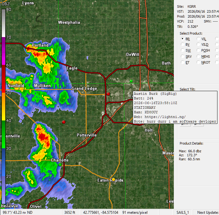
GRLevelX, GR2Analyst, and similar tools can stay part of the same chase workflow while Bolt provides its own live map and tracking context.
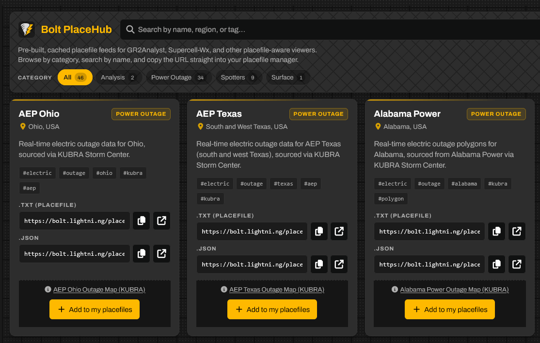
PlaceHub pulls in practical outside layers so you can keep higher-value context visible during a chase, not just weather products that look good in a demo.
PlaceHub
PlaceHub is for the feeds that make a field map more useful: power outages, warning polygons, surface context, and other operational layers that help explain what is happening around the storm.
It is meant to collect the data that actually matters on a chase day and keep it close enough to use without opening another tab.